Overview
This is not a hiking trail — it is a route. From the point you leave the marked trail above Alp Lawena, there are no waymarks, no path, and no safety net: route-finding, sure-footedness on steep grass and loose rock, and solid alpine judgement are all mandatory. The reward is a wild, little-visited ridge above Triesen that most hikers never see: a remote valley below Schwarzhorn, the Demmerahöhi ridge, the grass flanks of Plasteikopf, and a final boulder scramble to Hochspeler and Rappenstein.
This is graded T5 and completely pathless for good reason. Only attempt it if you are very fit, comfortable moving unroped over exposed terrain, and confident reading ground with no markers to guide you.
The Route
Triesen (Säga) → Alp Lawena: Start in Triesen at the Säga and follow the road up the valley toward Lawena. Continue past Alp Lawena on the marked trail.
Leaving the path: At the junction around P.1810, turn left first, following the path briefly in the direction of Rappenstein. Then leave it, turning off to the right to follow the stream upward into the remote valley beneath Schwarzhorn — this is where the marked trail ends.
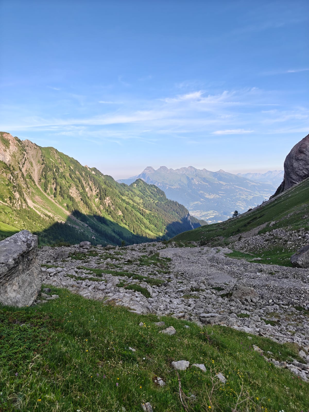 Looking back at the path, just after leaving it to follow the stream into the valley below Schwarzhorn.
To the back of the valley: Follow the valley all the way to its head, where a late-lying snow patch often fills the narrow gully beneath the ridge. From here, turn left and climb up toward the Demmerahöhi ridge.
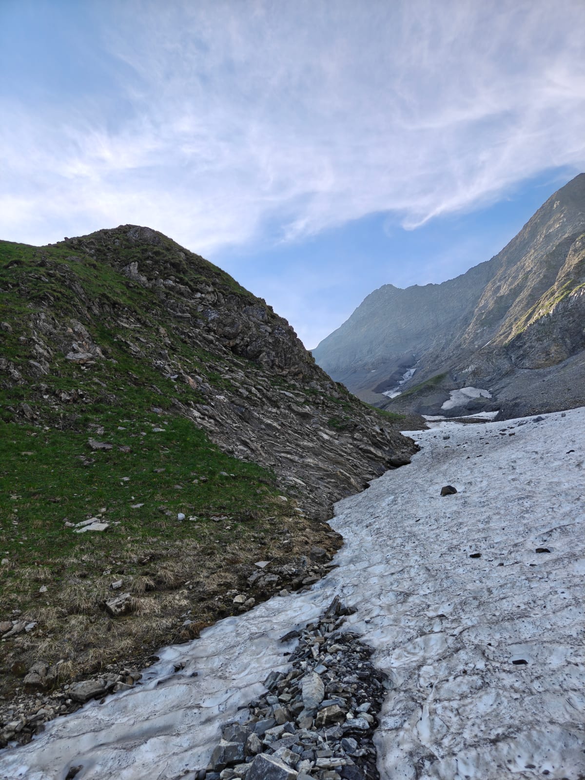 The back of the valley, with snow still lying in the gully in late June — turn left here toward Demmerahöhi.
Up to the Demmerahöhi ridge: Climb the open grass slope onto the ridge at Demmerahöhi.
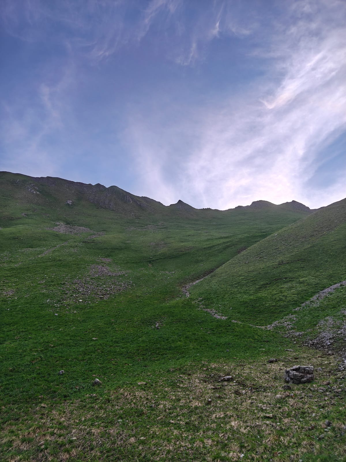 Climbing the grass slope to the Demmerahöhi ridge.
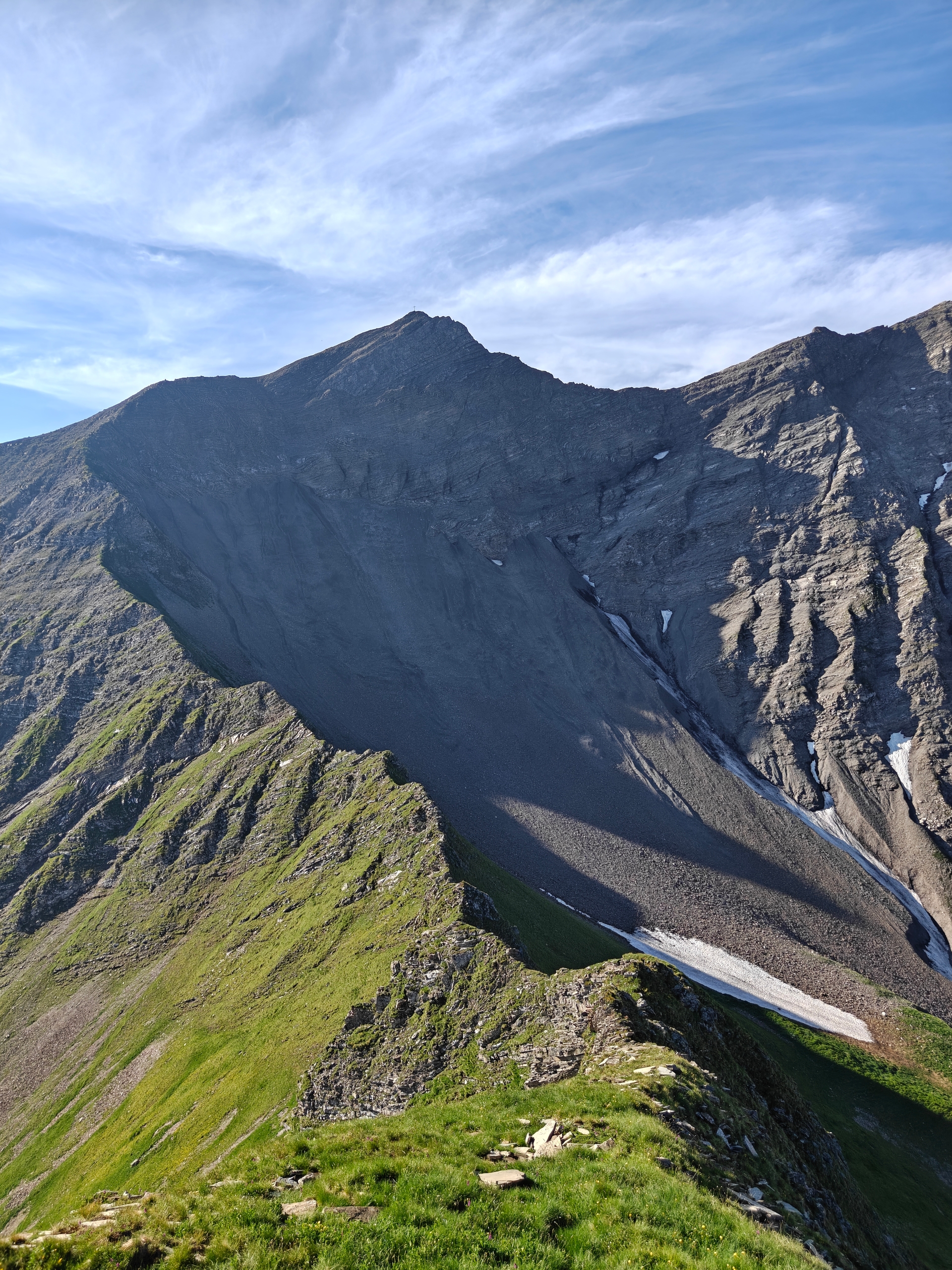
Demmerahöhi: From the top of Demmerahöhi, Schwarzhorn dominates the skyline behind you, its flank falling away into a huge scree bowl — not part of this route, but a striking landmark to look back on.
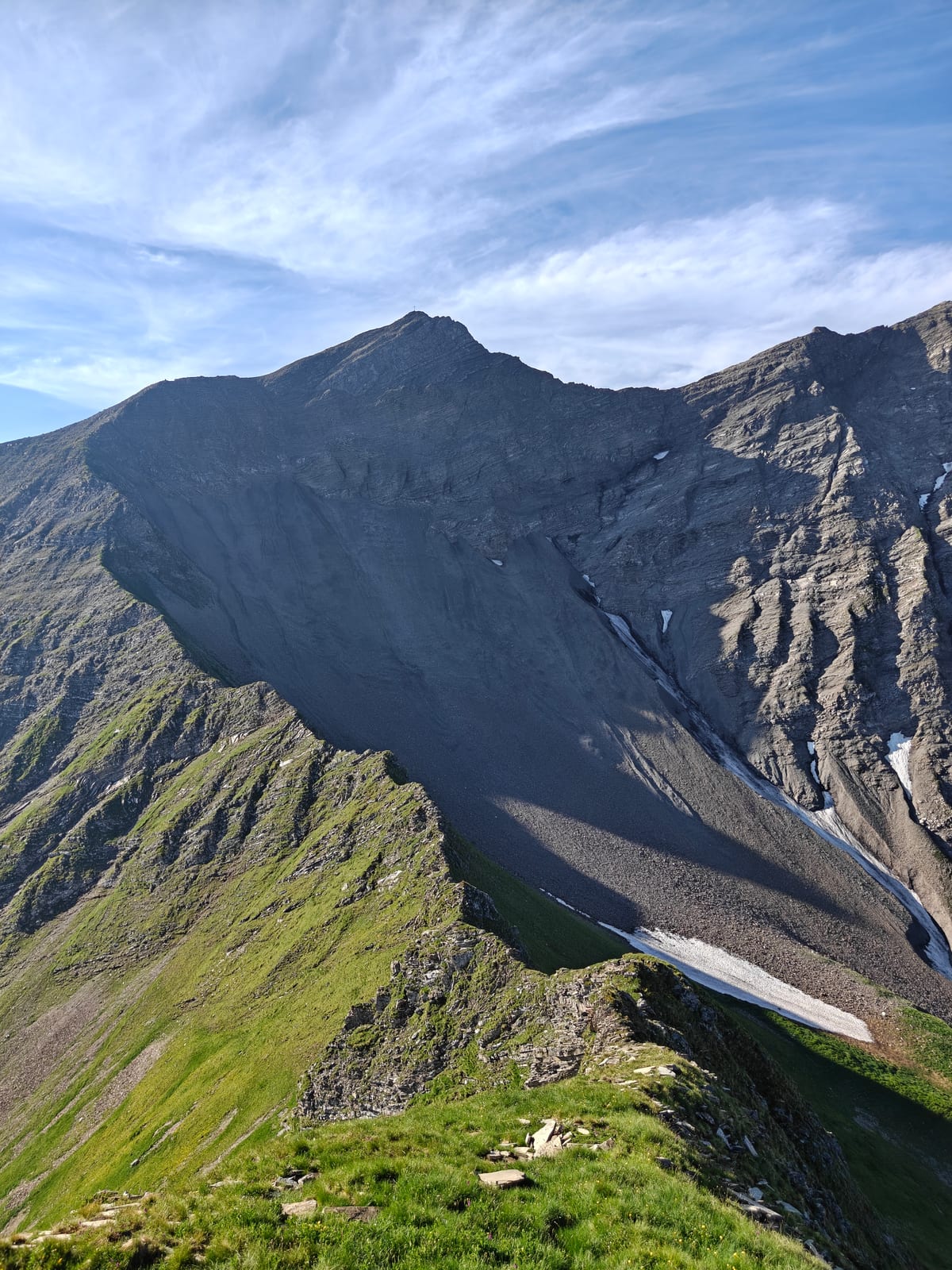 Looking back at Schwarzhorn from the top of Demmerahöhi.
On to Plasteikopf: Turning back around, the ridge ahead leads on to Plasteikopf, which looks considerably steeper and more exposed than it turns out to be. The trick is to find the well-terraced grass ledges that form a natural staircase up the flank, rather than fighting the rock directly.
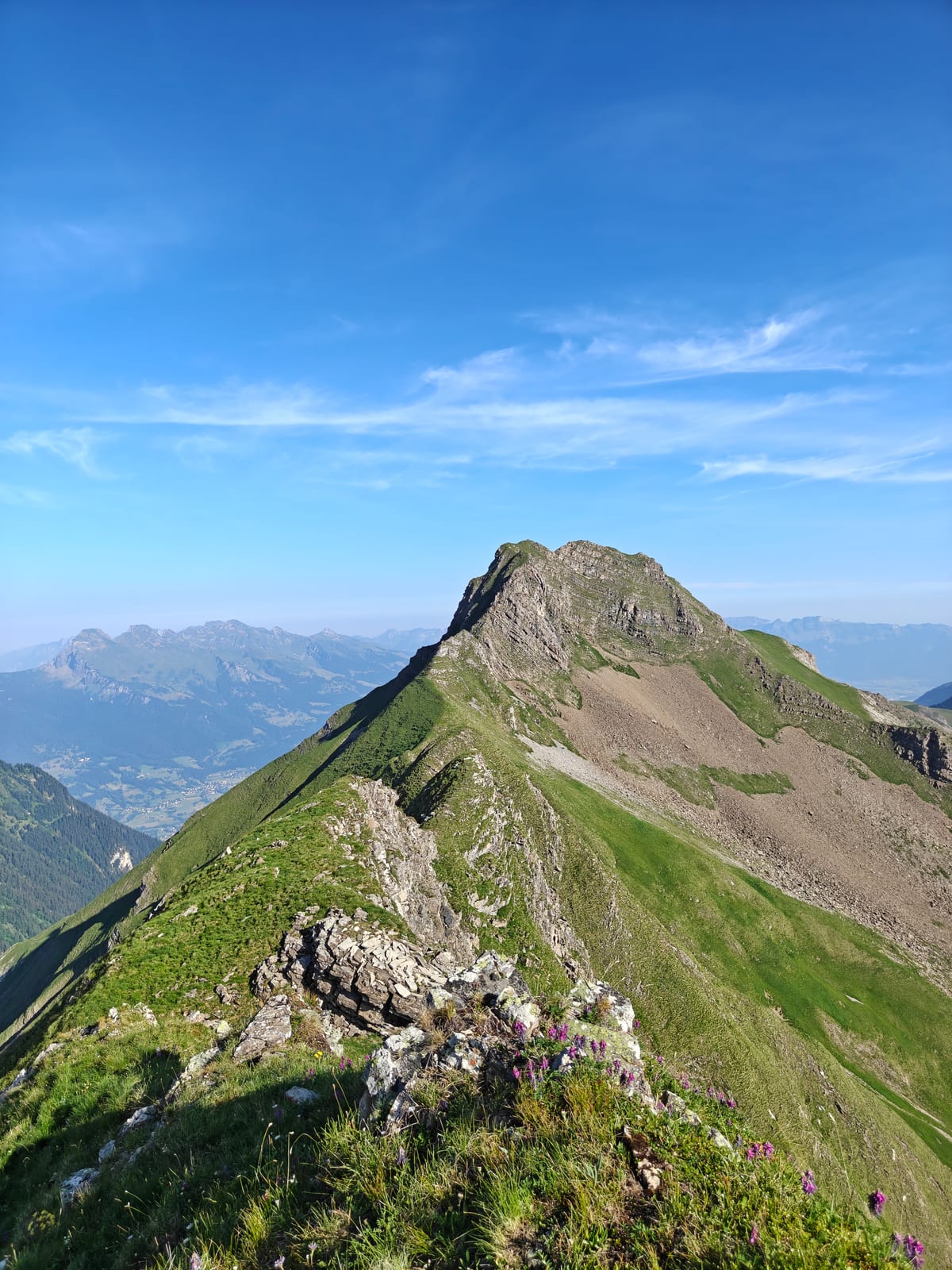 The ridge ahead, leading on to Plasteikopf — the way the route actually goes. The grass tongue used later to skirt the big drop is visible leading down in the top right of this photo.
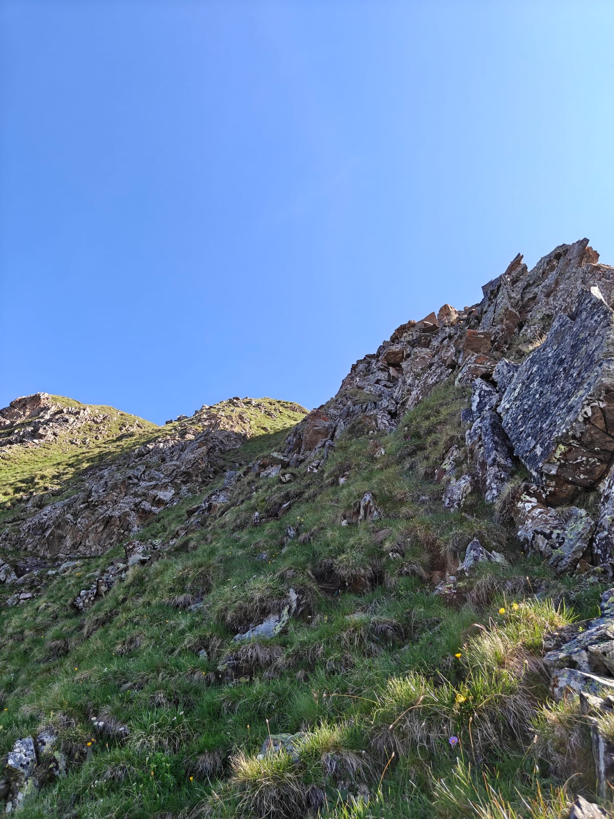 Climbing Plasteikopf on well-terraced grass ledges.
Plasteikopf summit: This is the top of Plasteikopf — and the view ahead shows the way the ridge continues on toward Rappenstein.
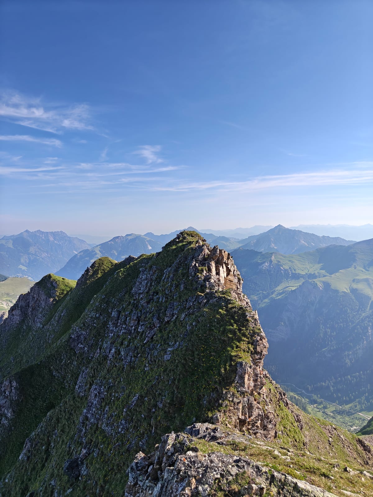 The summit of Plasteikopf, looking ahead along the ridge toward Rappenstein.
Looking back from the summit, the view takes in all the ground already covered — the remote valley, Demmerahöhi, and Schwarzhorn beyond.
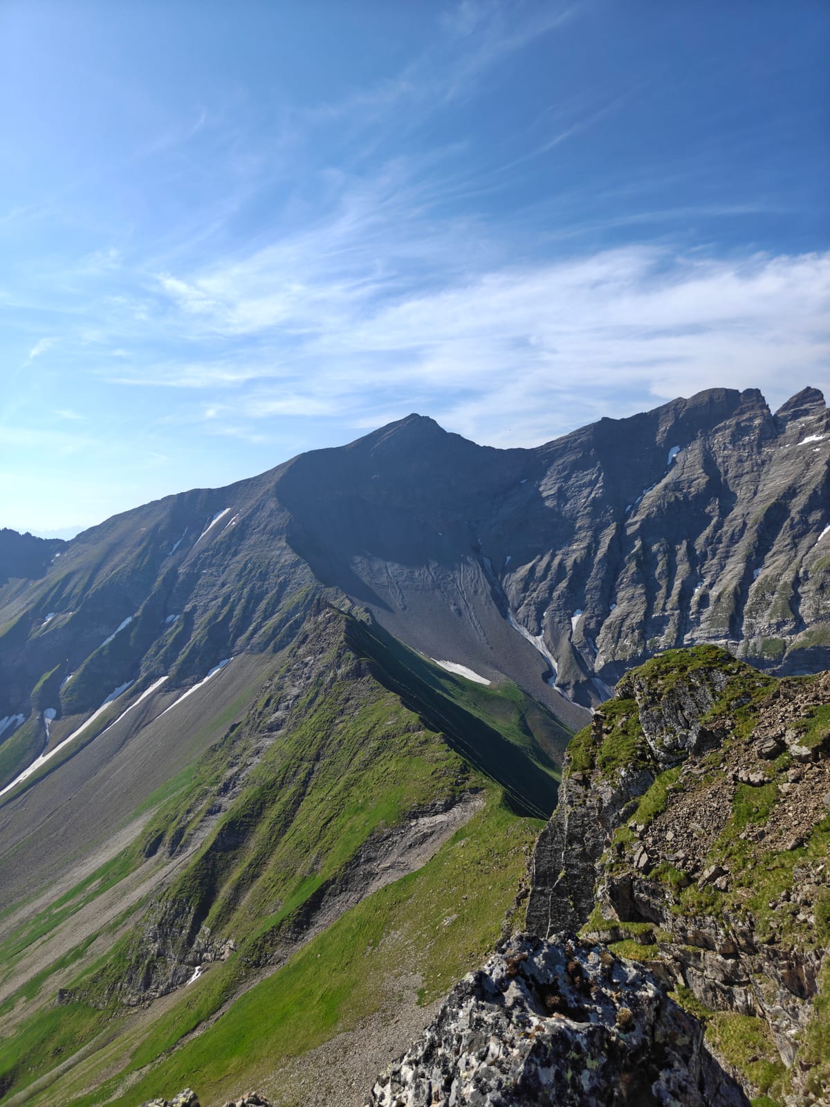 Looking back from near the summit of Plasteikopf, across the terrain already covered.
The grass tongue: From Plasteikopf, the ridge ahead is blocked by a huge drop. Do not go straight at it — instead, cross right onto the tongue of grass visible earlier from further back on the ridge (see the photo above), which leads down and around the top of the drop. Where the grass tongue runs out, turn left; this brings you around the huge drop that otherwise blocks the ridge.
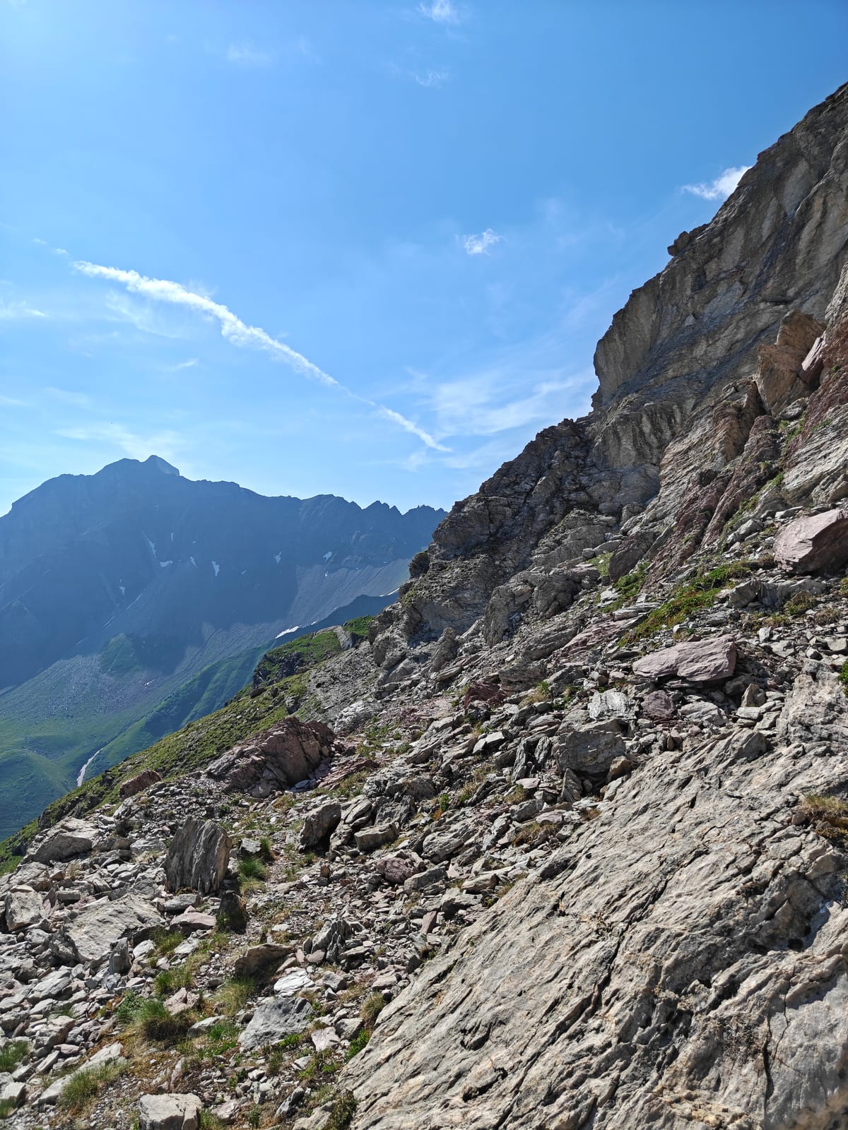 Looking back from just below the grass tongue, with the drop it skirts visible behind.
Boulders to Hochspeler and Rappenstein: Beyond the grass tongue, the terrain turns to blocky boulders. Pick your way across them to reach Hochspeler and, beyond it, Rappenstein. After Plasteikopf, this final stretch is comparatively easy going.
This route is only for very fit people who know what they are doing in the mountains.
Conditions & Season
- Best months: July–September, and only in fully snow-free, dry conditions
- Completely pathless from the point you leave the trail above Alp Lawena — solid navigation skills and a downloaded GPS track are essential
- The grass ridge becomes extremely slippery in wet conditions — do not attempt
- No huts or water sources along the ridge — carry everything you need
How to Get There
By bus: Liechtenstein Bus to Triesen, then walk to the Säga.
By car: Drive to Triesen and park near the Säga.
Return: From Rappenstein there are two options. The shorter way is a marked T2 trail leading directly down to Alp Lawena and back to Säga, retracing part of the approach. The longer alternative continues over Alp Gapfahl toward Steg through the Valüna valley, from where the bus runs back to Triesen Säga.